How good is the air quality in your garden? Or on the cycle path along the main road that’s part of your commute? This would be hard to find out from air quality measuring stations, which are very expensive and at fixed locations. But the AirBeam, a portable air quality tracker, can measure air quality in any location.
The AirBeam publishes all measurements on an open-source map, creating a visualisation of air quality across the entire world. HabitatMap, AirBeam’s developer, wants to enrich the existing network of data with hyper-localised air quality measurements. Existing measuring stations are rarely installed in places where people and animals are exposed to pollution, so AirBeam’s new data will paint a broader picture of this pollution’s impact.
What can the AirBeam measure?
The AirBeam is a battery-operated air quality measuring device about the size of a fire alarm. It takes five minutes to set it up, then users can measure the ambient temperature, humidity and minute quantities of harmful particles in the air. The measuring device indicates the concentration of these particles using the classifications for particle sizes that we have been familiar with since the coronavirus pandemic.
HabitatMap measures air quality in line with the standards laid out by the US Environmental Protection Agency. This involves dividing the detected PM2.5 concentrations, which in harmful quantities can lead to health problems such as asthma, pneumonia and even cancer, into four ranges from “harmless” to “very harmful”.
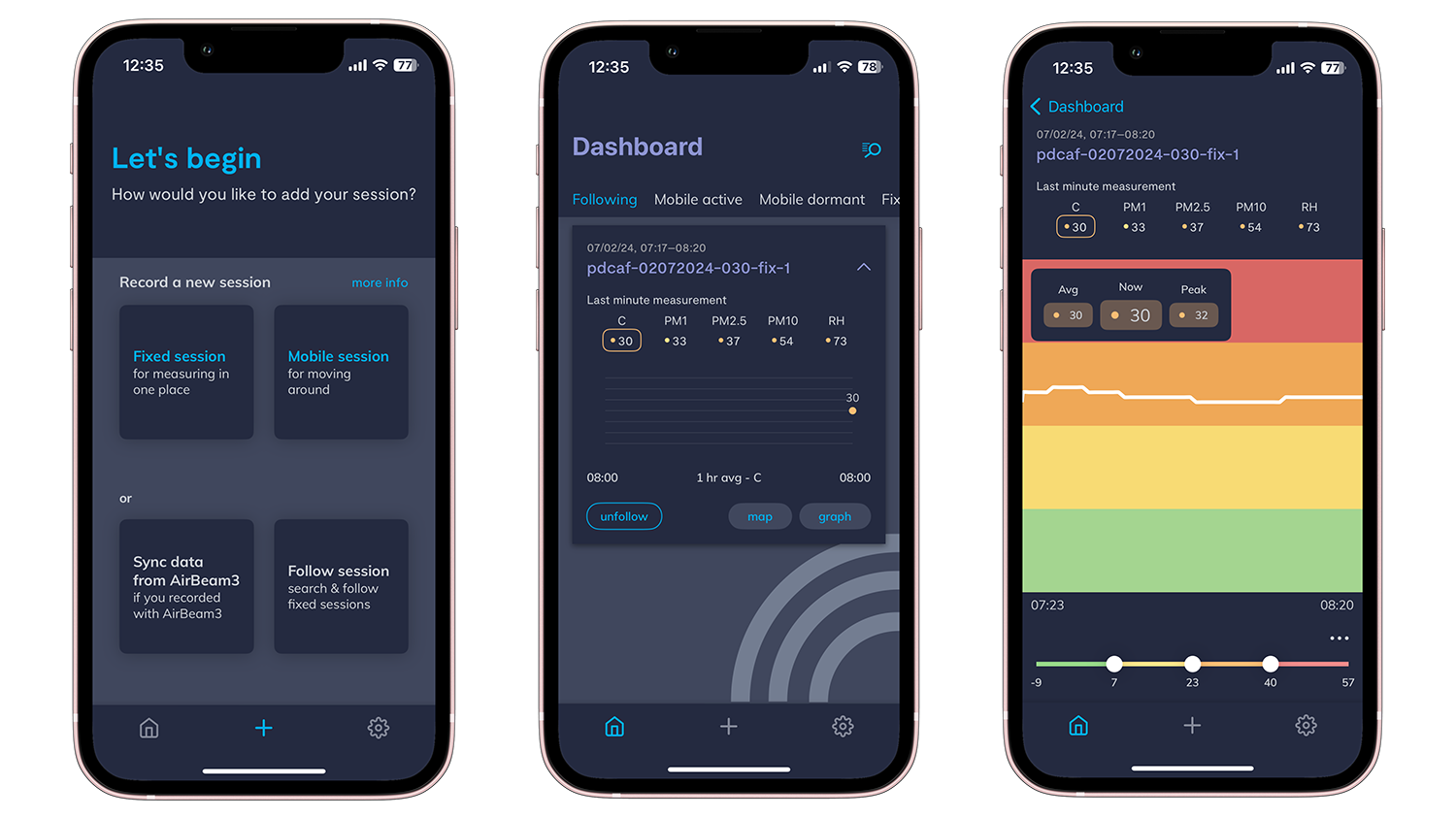
A special feature of the AirBeam, which is already in its second generation, is that it functions as a portable measuring device. Users can attach it to their bike handlebars or rucksack, for example, and then view the corresponding air quality in the “AirCasting” app.
A project in Chicago intelligently combines measurement data
The data that the AirBeam collects doesn’t just benefit users’ health. The AirCasting app also shows measurement data from other AirBeam devices and sensor platforms, but only for locations outside of Europe. You can look at the data collected by AirBeam devices everywhere from New York City to the Ghanaian city of Kumasi. On the manufacturer HabitatMap’s website, you can read about the various pilot projects which show the use cases for the AirBeam.
Residents of the US metropolis of Chicago, for example, are treated twice as often for asthma in hospitals than the national average, so the Environmental Law & Policy Center launched a programme a few years ago in which citizens used AirBeam devices to measure air quality. Chicago only has 12 fixed air quality measuring stations, which alone don’t give enough data to investigate the root cause of problems such as asthma.
Thanks to the AirBeam data, Chicago residents now have a much more detailed air quality map at their fingertips. As air quality is dependent on factors such as the current weather conditions, the time of year and the amount of traffic, people at risk in Chicago can now protect themselves much better. According to the project report, this is particularly beneficial for people in socially disadvantaged neighbourhoods. This is because exposure to particulate matter is particularly high in these neighbourhoods, where access to healthcare is also limited.
As well as working on local projects such as “Air Quality Chicago”, HabitatMap also makes its measurement data available worldwide via the open-source platform “World Air Quality Index”.
The open-source platform combines data from different measurement systems
The non-profit project “World Air Quality Index” was established in 2007. Investors from China, Singapore, India, Australia and the USA (along with thousands of private individuals) support the project in collecting air quality measurements and making them publicly available. HabitatMap uses the data from this project and combines the readings from its own devices on a freely accessible online platform.
This provides users with even more accurate air quality readings for their location. Both the World Air Quality Index and HabitatMap comply with the requirements of the European General Data Protection Regulation. However, users who do not wish to share their data can also switch off location sharing in the AirCasting app.
Local sensors will become even more important in the future
With a retail price of around 230 EUR per device, the AirBeam 3 is significantly cheaper than professional air quality measuring stations. However, the cost of the device means it’s not accessible to everyone. Programmes such as “Air Quality Chicago” are important pilot projects that show that health-relevant data should be available free of charge.
As a result of overpopulation, higher temperatures due to climate change and the delayed electrification of the transport and energy sectors, air quality will continue to deteriorate in many places around the world. This makes effective protection against particulate matter and gaseous pollutants such as ammonia and sulphur dioxide all the more important. Measures such as putting on a mask or buying an air filter can only be taken if people are able to find out about the air quality in their homes free of charge.
At the same time, the availability of air quality data can be an important political tool. Citizens can use so-called “civic tech” solutions to exert more pressure to demand political measures such as car-free city centres or traffic-calmed zones in regions where air pollution is particularly high.
The post Portable sensor AirBeam measures air quality—and shares its open-source data appeared first on Digital for Good | RESET.ORG.


